This page includes facts, fictions, suppositions, assertions, legends, and myths about Ellan Vhow. Where possible images of the original reference materials are included. (Images can be enlarged by clicking.) A separate References page which will include images of the title pages as well as full reference citations. Also see other informative pages at the links below ...
1. When the castle at Inveruglas was destroyed by Cromwell in the mid 17th century, the chief of the MacFarlanes took up residence at [...] Ellan Vhow.

Nisbet (1816) Vol. II, Appendix pg. 61
Nisbet indicates that Macfarlane was twice beseiged by Cromwell's troops "in his own house" and that "one of his houses [...] Inverouglas" was burned. This does not say that Inveruglas was burned twice or that Elanvow was beseiged.
Nisbet, Alexander, Gent. "A System of Heraldry, Speculative and Practical: With the true art of Blazon
according to the most approved Heralds in Europe: Illustrated with suitable examples of armorial
figures, and achievements of the most considerable surnames and families in Scotland, &c." 1816.
University of Toronto, Toronto, ON.
Macleod, D (1891) Historic families, notable people and memorabilia of Leven, Loch Lomond and
Cardross, [s.l.] Page(s): 230 Held at RCAHMS D.11.41.MAC
2. The castle at Ellan Vhow was NOT built after Inveruglas was burned
by Cromwell (17th century) ... as some sites/references suggest.
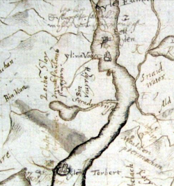
Pont's Map 1580 - National Library of Scotland
The seat of the clan did apparently move to Elanvow and Tarbet at that time, but the castle was built earlier and existed in the late 16th century. The existence of the castle in in the 16th century is evidenced by Timothy Pont's map (1590) at left ... showing a castle on "ylina Vow".
Aside: Note that Inveruglas Isle is not shown at all. It would be at Inveruglas (where the black stream .. dhu glas .. enters the loch from the stream fed by Loch Sloy). The location is clear on the map. Tarbet Isle is also located correctly on the map ... so he has not mistaken one for the other. Since Inveruglas was in ruins and the MacFarlane at Elanvow/Tarbet, Inveruglas may not have been noteworthy to Pont or simply overlooked.
Aside: Note that Inveruglas Isle is not shown at all. It would be at Inveruglas (where the black stream .. dhu glas .. enters the loch from the stream fed by Loch Sloy). The location is clear on the map. Tarbet Isle is also located correctly on the map ... so he has not mistaken one for the other. Since Inveruglas was in ruins and the MacFarlane at Elanvow/Tarbet, Inveruglas may not have been noteworthy to Pont or simply overlooked.
3. The castle was built in 1577 by Andrew MacFarlane.
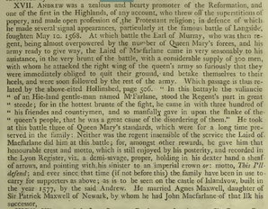
Nisbet (1816) Vol. II, Appendix p. 69
(Click to Enlarge)
Nisbet, Alexander, Gent. "A System of Heraldry,
Speculative and Practical: With the true art of Blazon
according to the most approved Heralds in Europe:
Illustrated with suitable examples of armorial
figures, and achievements of the most considerable
surnames and families in Scotland, &c." 1816.
University of Toronto, Toronto, ON.
Referenced by:
Fraser, William. The Chiefs of Colquhoun and Their
Country. Vol. 1. Edinburgh, 1869. PDF.
4. Alexander of Duchray suggests the house was still inhabited in 1724
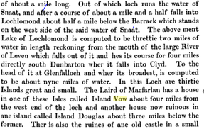
Alexander Graham of Duchray, 1724, from Buchanan
Publications of the Scottish History Society, Volume 51, Page 345, Buchanan includes notes from Alexander Graham of Duchray ca. 1724.
In this case this merely notes the existence of a house on Island Vow at the time and that the house on Island Douglas (Inveruglas) was in ruins.
In this case this merely notes the existence of a house on Island Vow at the time and that the house on Island Douglas (Inveruglas) was in ruins.
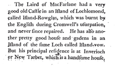
5. In 1743 the castle was described as a 'pretty good house with gardens' by Buchanan of Auchmar.
|
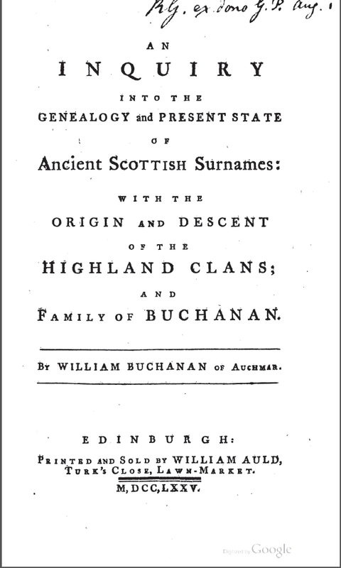
"An Inquiry into the Genealogy and Present State of Ancient Scottish Surnames: With the Origin and Descent of the Highland Clans and Family of Buchanan", William Buchanan of Auchmar, 1775
Island-Rowglas is, of course, a reference to Inveruglas Isle. Row glas, dhu glas, douglas .. black water and "Inver" q-Celtic for "carry into" or confluence of waters. |
6. The relative emptiness of the eastern side of the island suggests it may
have been used for livestock or small scale agricultural production or
gardening.
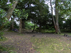
Today the clearing is used as a camping ground for visitors, although this practice is highly discouraged as it damages the remaining sites on the island. The presence of the clearing and two Rowan trees, trees considered sacred by the early Scots, supports Buchanan's statement of a "pretty good house with gardens", as the Rowan trees, who were foreign to western Scotland, would no doubt have been the focal point of the MacFarlane's gardens.
Note also that Timothy Pont's texts (ca. 1790) for annotation of his maps, include "thrie myl thence [from Terbart to the north] Ylen-ow with a fair dwelling with orchards, it is of equal distance from both sydes of the loch, which is heir a myl broad [or rather 3/4]. "
Joan Blaeu, probably influenced by Pont, wrote "From the Tarbet Isle three miles to the north is Yland Ow [Island I Vow], noted for fine houses, gardens and groves." (NLS)
7. When William Wordsworth visited the area in 1814, the castle was in ruins. His visit and supposed encounter with a hermit residing there inspired his poem, "The Brownie's Cell".
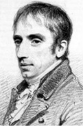
William Wordsworth
...From year to year this shaggy Mortal went
(So seemed it) down a strange descent:
Till they, who saw his outward frame,
Fixed on him an unhallowed name;
Him, free from all malicious taint,
And guiding, like the Patmos Saint,
A pen unwearied--to indite,
In his lone Isle, the dreams of night;
Impassioned dreams, that strove to span
The faded glories of his Clan! ...
The full poem can be found or our Wordsworth page or here
8. A stone with the Macfarlane armorial bearings (coat of arms) was embedded in a wall of Ellan Vhow
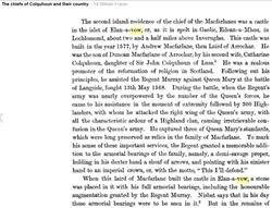
Armorial Bearings - Fraser
Note the reference by William Fraser to the armorial bearings in a stone in the castle Ellan Vhow. Fraser lists Nisbet (1804), Vol. II, p. 61 as reference for this (see below), but nothing else.
Fraser, Sir William.
The Chiefs of Colquhoun and Their Country, Vol. II, p. 78
Fraser, Sir William.
The Chiefs of Colquhoun and Their Country, Vol. II, p. 78
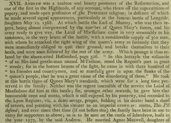
Armorial Bearings - Nisbet (1816)
Nisbet's reference: "as to be seen on the castle Islandvow".
If a stone bearing the Macfarlane coat of arms had been salvaged from the ruins, it would certainly be known to Macfarlanes. If the stone were damaged, it is less likely it would have been salvaged and it may lay in the rubble of the current ruins. If we lay the groundwork for excavation, this is one of the things we hope we might find.
Nisbet, Alexander, Gent. "A System of Heraldry, Speculative and Practical: With the true art of Blazon
according to the most approved Heralds in Europe: Illustrated with suitable examples of armorial
figures, and achievements of the most considerable surnames and families in Scotland, &c." 1816.
University of Toronto, Toronto, ON.
9. Elanvow was ruined by 1791 or earlier.
From memoirs highlighted to us by Andrew Macfarlane of New Zealand that were provided by Diane Wilson: The Memoir is a ‘gathering of conversations’ he had with his father (also named) Rev Duncan MacFarlan (1708-1791). In it is this reference to Ellan Vhow; It was supposed that this supports the notion that Ellan Vhow was ruined before 1791. This is likely in any case, but it is unclear from the text is his father indicated that it was ruined or if the author .. Duncan MacFarlan II (?) was speaking of the then ruined Ellan-a-vue. We have references if any one wants to dig further into this.
“My Father was their eldest child. He was born on the 9th June, 1708. The cottage where
he first saw the light is situated at the N.W. extremity of the Parish of Buchanan and County of
Stirling, on the banks of Loch Lomond. (PFM - it is a small farm shown on the 1860 OS map as Pollocrow)
Its situation is wild and romantic in the highest degree. At the foot of an almost perpendicular mountain, on the very margin of the lake, there narrowed and
shut in by hills broken in every variety of height, while here and there a gloomy ravine opens the
prospect of remote and still loftier summits diversified with all those lights and shades with which
an ever-changing atmosphere chequers the distances of that Alpine scenery; it commanded in
front a full view of the lovely Ellan-a-vue with its venerable trees and ruined Castle, once the
fortress of a powerful Chieftain, now the sad memorial of civil war and unrelenting bigotry.”
10. The island may have been occupied in the 11th and 12th centuries.
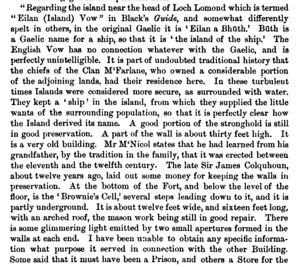
Sir James Culquhoun provided funds to repair the tower .. 12 years earlier .. than 1873? ... 19th century. From "The Poetical Works of William Wordsworth", Volume 6, 1884.
11. Robert the Bruce may have planted Yews on the island. ???
A historical perspective, drawn from the Ordnance Gazetteer of Scotland: A Survey of Scottish Topography, Statistical, Biographical and Historical, edited by Francis H. Groome and originally published in parts by Thomas C. Jack, Grange Publishing Works, Edinburgh between 1882 and 1885.
"In 1306, after the Battle of Dalree, Robert Bruce is said to have taken refuge in what is now Rob Roy's Cave, and at this time also to have planted many of the yew trees on Eilan Vow, while subsequently he is accredited with having caused many trees of the same kind to be planted on Inchlonaig, to provide a supply of bows for his soldiers."
RBM Note the references to Inch Vow and Eilan Vow. Also the story of submerged island and house.
12. An alms house was built opposite Eilean-a-vow.
From James MacFarland's History of the Clan Macfarlane...
Between 1612 and 1624 (.. if assumed while John was Chief)? ... or earlier?
[EVPF] John become Lord of the lands (with Andrew retaining a life rent) in 1581 (Fraser 98) so perhaps he had the means and authority well before he became Chief.
However, note that the quote says the armorial bearings on the front of the almshouse included those of this fourth wife. Records we found suggested he married his fourth wife "about 1620". We would conclude that the almshouse was built during the time John was Chief and, perhaps, in the latter part o that period. Any information about when he was still married to his third wife could be relevant to dating the almshouse better.
John, as we have said, is stated to have been a gentleman of great piety. "He built an almshouse at Bruitford on the mainland opposite to his castle on the island called Eilean-a-vow, for the reception of poor io6 History of Clan MacFarlane passengers who might happen to require shelter in visiting or passing through the district. This he endowed with competent revenues to provide the travellers with all necessities and accommodation. On the front of the almshouse was handsomely cut in stone his armorial bearings, with party per pale, baron and femme, three mullets being the arms of Margaret Murray, his fourth wife. " The almshouse referred to no longer exists, although at a place opposite Eilean-a-vow, on the mainland, the wall tracks of a house can yet be traced. The spot is called Croit a' phuirt, generally pronounced Crutyforst or Crutafoorst. It means the croft of the landing, or where persons embark and disembark from a small boat."
13. Natural Steps seem to exist at the SW corner at the large boulder
These are most likely naturally occurring ... but would have been convenient ... particularly since water levels were reportedly and significantly lower while the island was in use.
14. Eilean A Vow was used as a store
[EVPF] This is an important point in that it is was called Eilean a Bhuth (Island of the Store or Booth) in the early 18th century. This would have likely been in the time when the chief's residence had shifted to Arrochar. One cite says it was an Andrew that lived on the island and delivered goods to the locals. There is another reference suggesting that is was near the beginning of this century .. in an apparent 18th century reference. Usage of this term seemed to be 18th century and Winchester says it was a relatively new name and the island was previously called Eilean Ur (the New island). References suggest that Eilean Ur began use either after the tower was built (1577) or after the clan seat moved to Elanvow in the latter 1650's. Andrew 18th chief was on the island through 1685 but it is unclear why he would be selling goods to the locals. Our theory is that another Andrew occupied the island after the chiefs moved to Arrochar and, perhaps, this Andrew sold goods to the locals and goods were stored on the island.
"Store" in the Gaelic seems to a booth or place where you buy things ... rather than a storage facility ... although the difference between the two can be subtle.
15. Was there a chapel on the Island? (In Progress)
Building 2 is oriented East-West and there seems to be a base of stones on the East interior. This prompted speculation that this could have been a Chapel. It is also on a relative high point on the island. There are references to daffodils on the island with a note that daffodils were often planted in the vicinity of churches to supply flowers. Wordsworth does mention a "consecrated pile" in his poem The Brownie's Cell ... but most have suggested he may have confused Elanvow with another island.
Building 2 is oriented East-West and there seems to be a base of stones on the East interior. This prompted speculation that this could have been a Chapel. It is also on a relative high point on the island. There are references to daffodils on the island with a note that daffodils were often planted in the vicinity of churches to supply flowers. Wordsworth does mention a "consecrated pile" in his poem The Brownie's Cell ... but most have suggested he may have confused Elanvow with another island.
16. Were all the chiefs that inhabited the island Protestant? (TBD)
We know Andrew 11th was Protestant.
