Canoe Launch Points for Island I Vow and Almshouse Location
CAUTION: There have been reported fatalities at this site when the water is high and the sandy spit apparently behaves like quick-sand. Please consider other launch points and proceed with extreme caution!
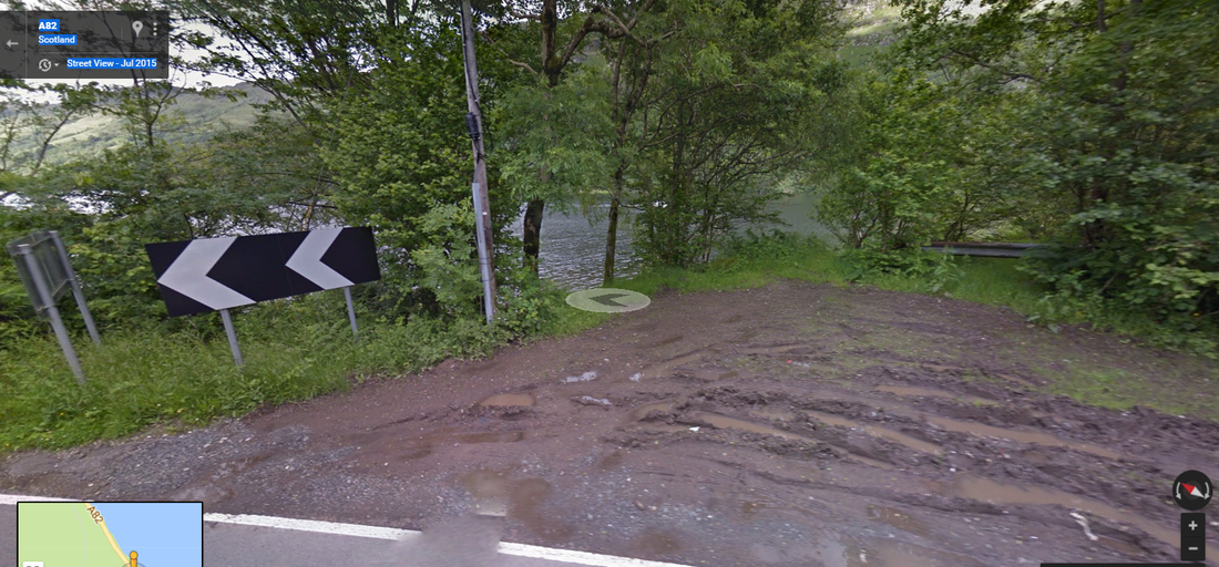
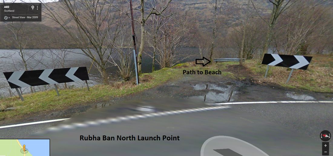
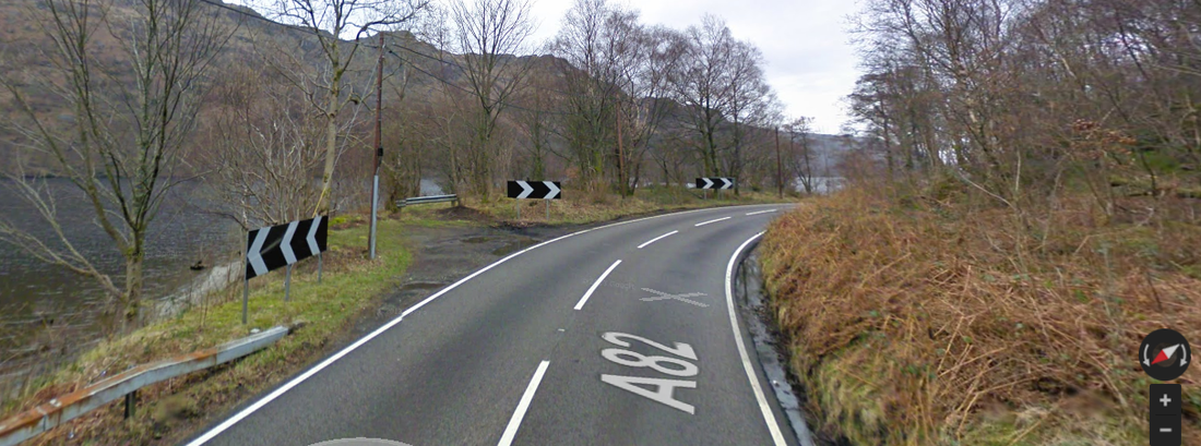
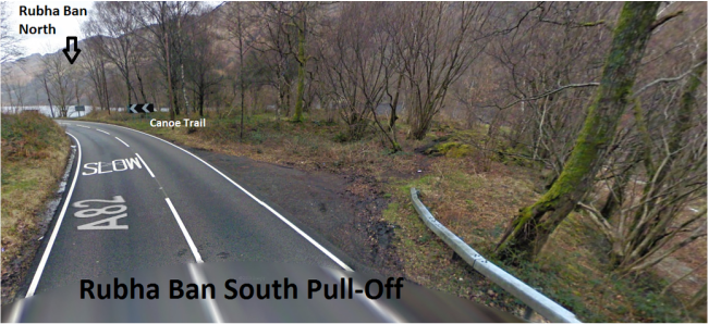
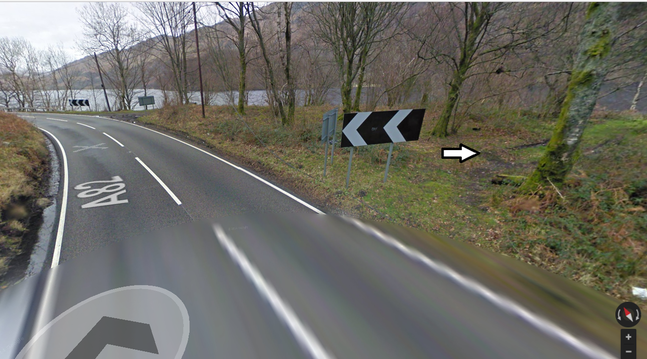
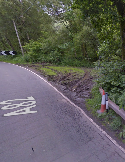
One canoe launch point is from Rudha/Rubha Ban ... the sandy point just north of Elanvow. It is a bit difficult to spot, so we suggest finding the Alternate Launch point (below) first. There are two pull-offs just north of the Alternate Launch Point. The northern most of the two is probably the easiest to use. We'll call that Rubha Ban North. You will need carry the canoe about 100 yards from the pull-off to the sandy/gravel beach, but the beach is perfect for canoe launch and places you north-south in trips to the island. We call the pull-off between Rubha Ban North and the Alternate Launch site "Rubha Ban South". You will need to carry the canoe along the roadside for 10 yards or so to the Curve Warning [<<<] sign and cut in there. Both North and South converge on a grassy platform suitable for camping and a cut down to the beach. There is evidence that 4WD (or other adventurous vehicles) have pulled in just south of the sign and, perhaps, parked at the camp site, but it is a tight fit with muddy conditions as of this report. Rubha Ban North has an easily accessible path to the platform and beach but is now cordoned off. Coordinates for Rubha Ban North are 56.282338, -4.700601. (View in Google Maps)
The natural landing on the island is the north beach and you will likely either have the wind at your back or will heading straight into the wind. The latter is better than paddling across the wind from the alternate site. Even heading south into the wind, when you get in the wind shadow of the island, the paddling is easier.
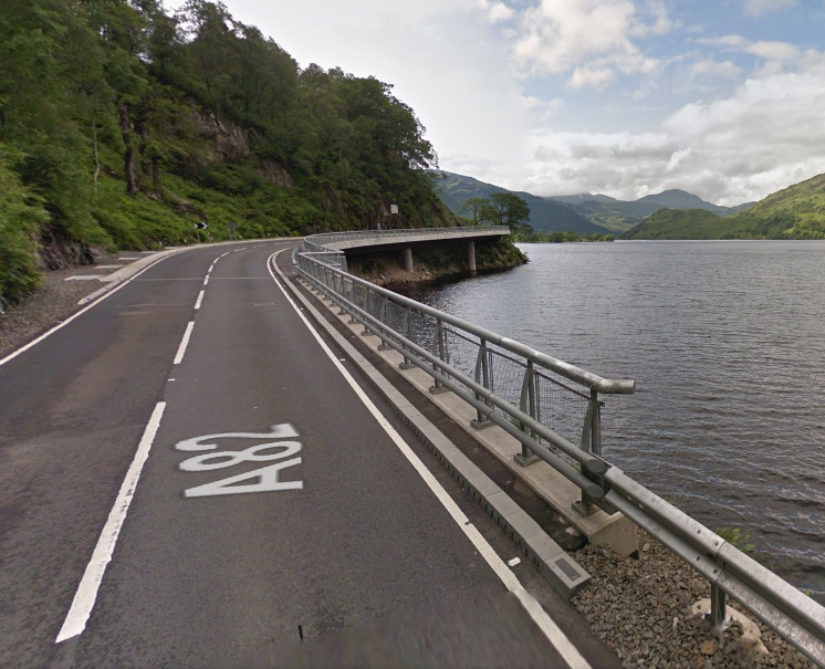
We preferred to approach the Rubha Ban Northpull-off from north to south, but it can be pulled into from the northbound lane if you spot it. Portions of the pull-off where quite muddy in September 2016. If you are coming south from Ardlui, it is the first pull-off on the loch side after the new overhanging section of A82 at Pulpit Rock. Note that the roads a narrow and it is not trivial to turn around.
We provide info on Rubha Ban North and South below, but want to highlight The Alternate Launch Site first as a more recognizable visual reference point to help locate the other two.
The Alternate Launch Site
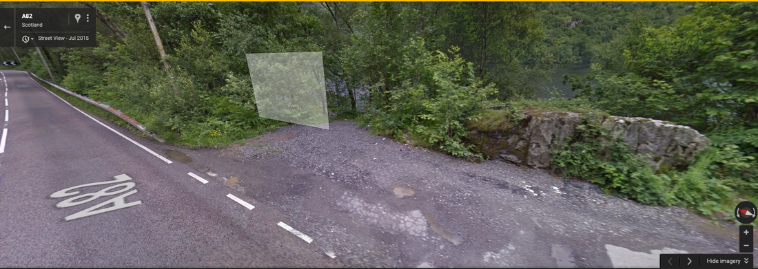
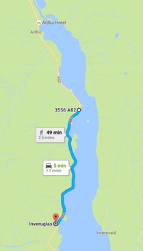
There is also a reasonable canoe launch point along the A82 at about 56.280725, -4.701024. This is about 2.5 miles north of the Inveruglas car park on the A82. This is north of Ardvorlich.
This is also probably the safest parking spot near the Almshouse site. See at bottom.
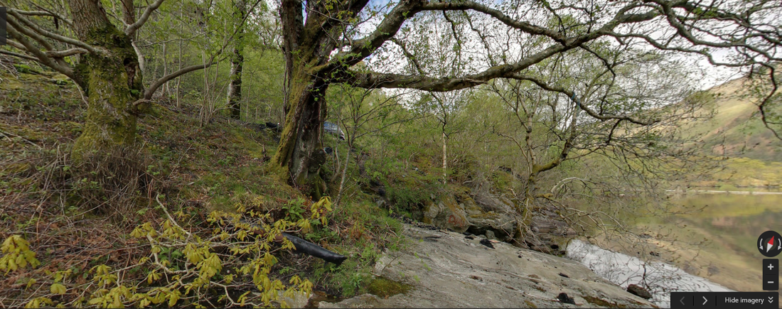
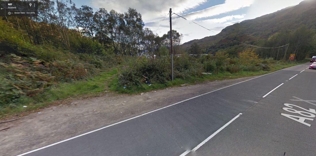
At the Alternate Site, there is a large boulder at a pull-out on the loch-side. Even though steep, you can get a canoe down to a flat rocky area at water's edge for a launch ... with the car parked just above.
Others apparently found this to be a significant point since it had a 360 street view from water's edge. Click here for the view of the stop at the A82 level. Click here to view at the water level below that. (Note that the white rectangle is a Google object and not really in the scene. Likewise the A82 on the road. Look for the loch side boulder at the pull off.)
It is rocky and steep (about 10 feet) down to the water, but a tarp can protect the canoe as it is slid down to the flat bedrock below. Better with two people, of course.
Rubha Ban North (Preferred Launch Site)
2023 Update - Now cordoned off
The preferred canoe launch point is Rubha Ban North (56.282338, -4.700601) about 200 yards or 0.1 mile north of the Alternate Launch point. Again, you will need to carry the canoe about 100 yards to the beach, but the path is easy along the shoreline.
We preferred to come from north to south. The Rubha Ban North Launch point is the firstloch-side pull-off south of the overhanging road improvements at Pulpit Rock (shown below for reference).
Rubha Ban South
The pull-off immediately north of the Alternate Launch point is Rubha Ban South. The path to the beach and camp site is just south of the Curve Warning sign ([<<<]). It is perhaps a bit more dangerous to carry the canoe along the edge of the road to get to the path from the pull-off ... so we recommend using Rubha Ban North.
17th Century Macfarlane Almshouse site
There is a small pull-off on the loch side about 200 yards south of The Alternate Site ... after a long loch-side guard rail and just north of a telephone pole. It may be safer to park at the Alternate site and walk. Follow the path toward the loch and then bend south toward a rocky outcrop. See label at Google maps.
Likely dated to the early 17th century since it reportedly included arms from John's (14th chief) fourth wife (Margaret) which places it near 1620 perhaps.
